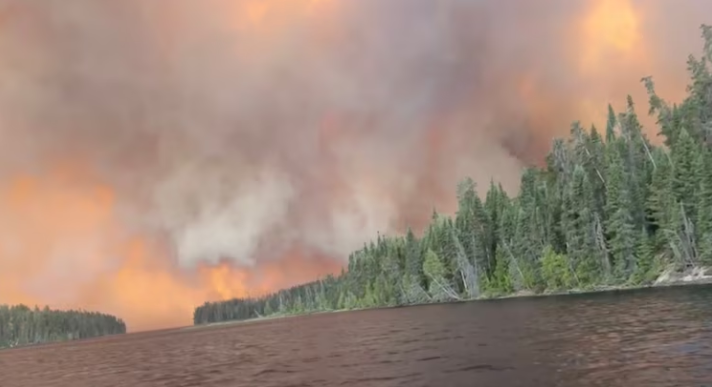
On May 18, 1980, an earthquake struck below the north face of Mount St. Helens in Washington state, triggering the largest landslide in recorded history and a major volcanic eruption that scattered ash across a dozen states. The sudden lateral blast—heard hundreds of miles away—removed 1,300 feet off the top of the volcano, sending shock waves and pyroclastic flows across the surrounding landscape, flattening forests, melting snow and ice, and generating massive mudflows. A total of 57 people lost their lives in the disaster. This anniversary always hits home for me, as I was a 12-year-old living in Spokane at the time. I have such vivid memories of the approaching ash cloud, the bizarre dark skies at daytime, the uncertain fears of inhaling the ash, deserted streets, and closed schools.
-
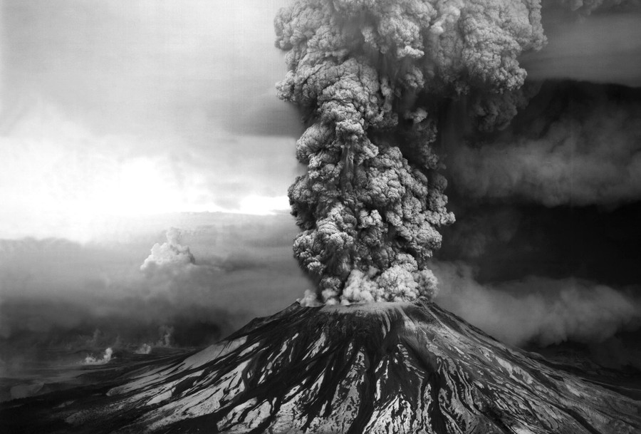
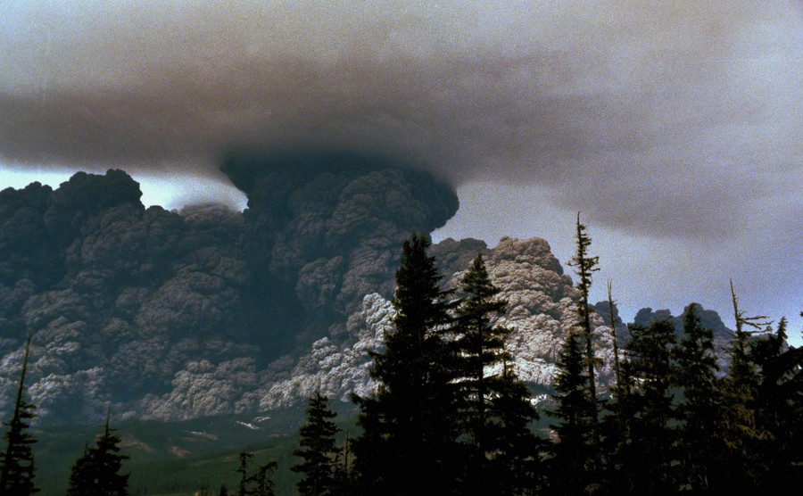
An ash plume billows from the crater atop Mount St. Helens hours after its eruption began on May 18th, 1980, in Washington State. The column of ash and gas reached 15 miles into the atmosphere, depositing ash across a dozen states. #
USGS / Robert Krimmel -

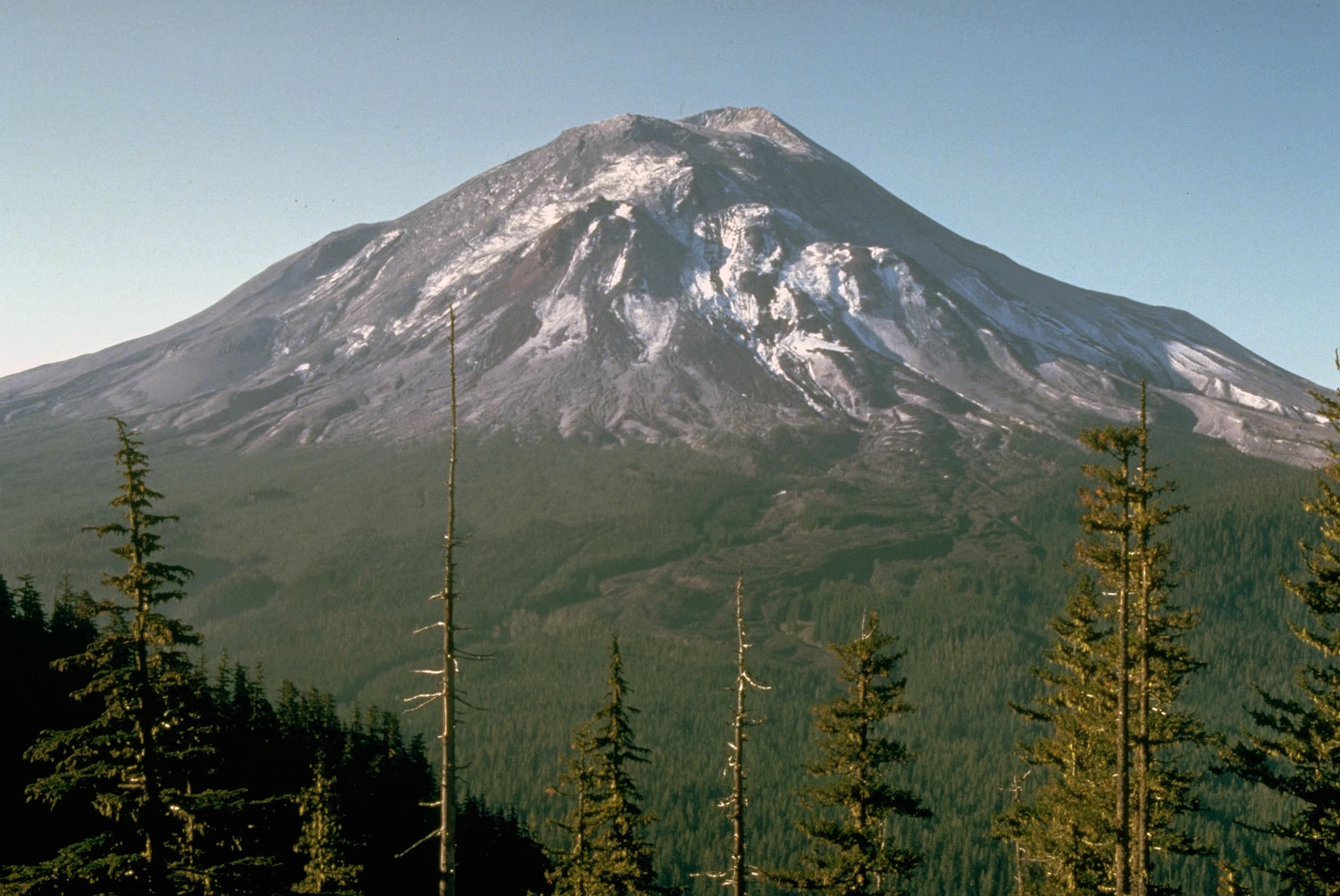
Mount St. Helens, as it looked the day before its massive eruption, on May 17, 1980 #
USGS Cascades Volcano Observatory, Harry Glicken, file/Via AP -
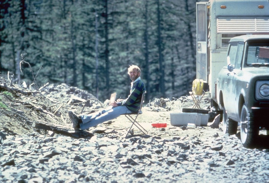
On May 17, 1980, the vulcanologist David Johnston sits at Coldwater II camp near Mt. St. Helens. At 8:32 a.m. the next morning, Johnston radioed a message to the USGS headquarters: “Vancouver, Vancouver, this is it!” Johnston did not survive the eruption. Coldwater II was later re-named Johnston Ridge, in honor of Johnston. #
Harry Glicken / USGS -
An animated series of images showing the May 18, 1980, eruption of Mt. St. Helens. Clearly visible in the first few images is the largest recorded landslide in history—the entire north face of the volcano sliding away, following a shallow earthquake. The newly-exposed core of the volcano then erupted. #
AP -

Mount St. Helens erupts again, on July 22, 1980. #
Jack Smith / AP -
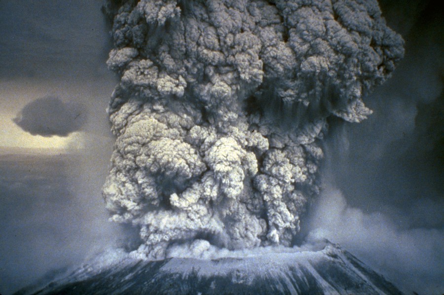
Mount St. Helens erupts on May 18, 1980. #
AP -
Mt. St. Helens on May 18, 1980 #
NOAA News Photo -
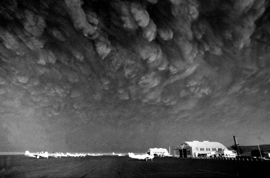
Ash clouds from Mount St. Helens move over Ephrata Airport in Washington State on Monday, May 19, 1980. Communities across central and eastern Washington were covered in three to four inches of gritty and fine ash particles. #
Mike Cash / AP -

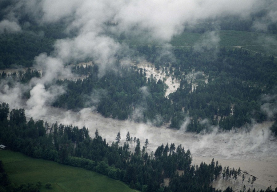
A house is submerged along the Toutle River, which flooded in the aftermath of the eruption of Mount St. Helens on May 19, 1980. Area streams and rivers rose quickly as ice and snow on the volcano melted instantly. #
AP -
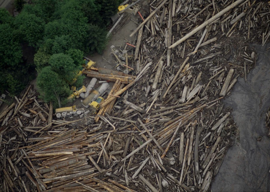
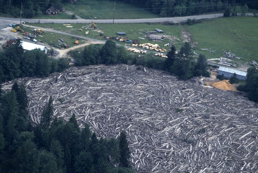
A logging operation along the Toutle River, Washington, about 20 miles from Mount St. Helens, in ruins after flooding from ice and snow melt from the mountain, in May of 1980 #
AP -
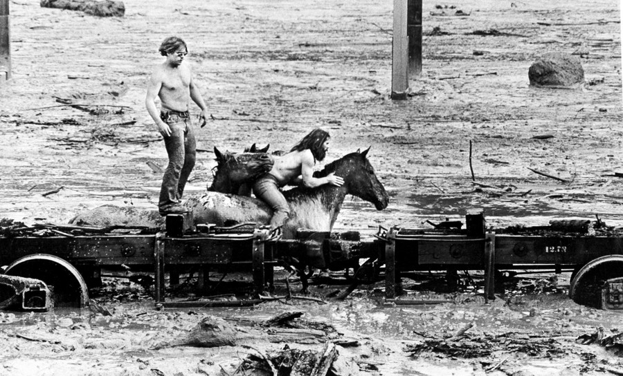
Bob Brown (left) and his brother John attempt to lead three horses to safety out of the Weyerhaeuser 19 Mile camp in Kid Valley, Washington. The yard was flooded by the Toutle River following the eruption of Mount St. Helens. #
Gary Stewart/ / AP -
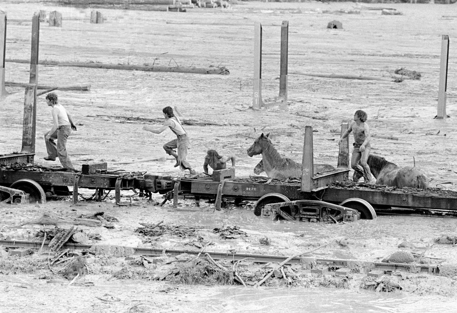
Bob Brown (right) and John Brown climb onto railroad car, heading down the train along with two additional would-be horse rescuers, giving up their efforts as they flee for their lives, after flood waters from the Toutle River began a sudden rise on May 19, 1980. All four people reached safety, but the horses are presumed to have drowned. #
Gary Stewart/ / AP -
Steam rises from hot water in a river following the aftermath of the eruption of Mount St. Helens, on May 19, 1980 #
AP -
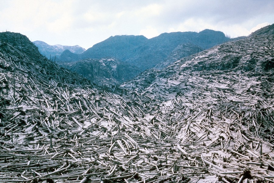
Aerial view of timber blowdown, destroyed by the May 18 eruption of Mount St. Helens, in Skamania County, Washington, on June 8, 1980 #
USGS -
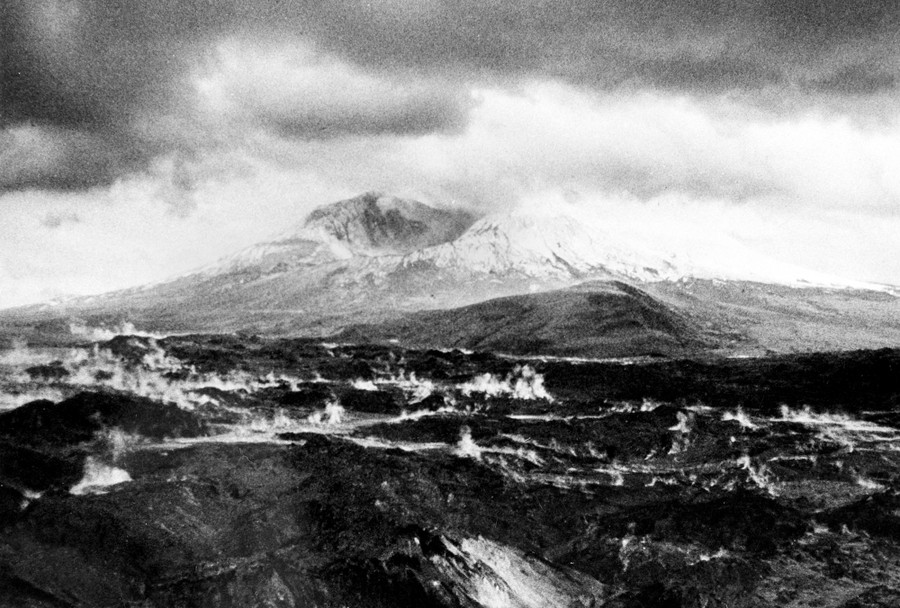
The crater left at the summit of Mount St. Helens, after it lost more than 1,300 feet of elevation to the catastrophic landslide and eruption of May 18, 1980, the surrounding landscape still steaming #
AP -
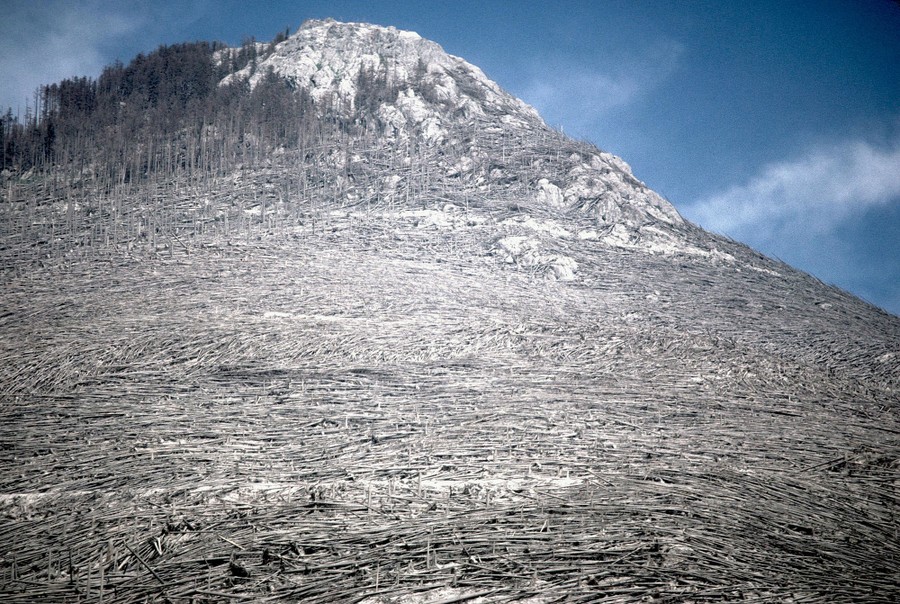
Blowdown of trees from the May 18, 1980 eruption of Mount St. Helens, viewed on August 22, 1980 #
Lyn Topinka / USGS -
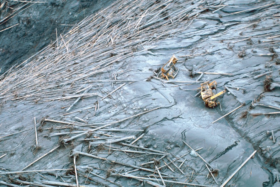
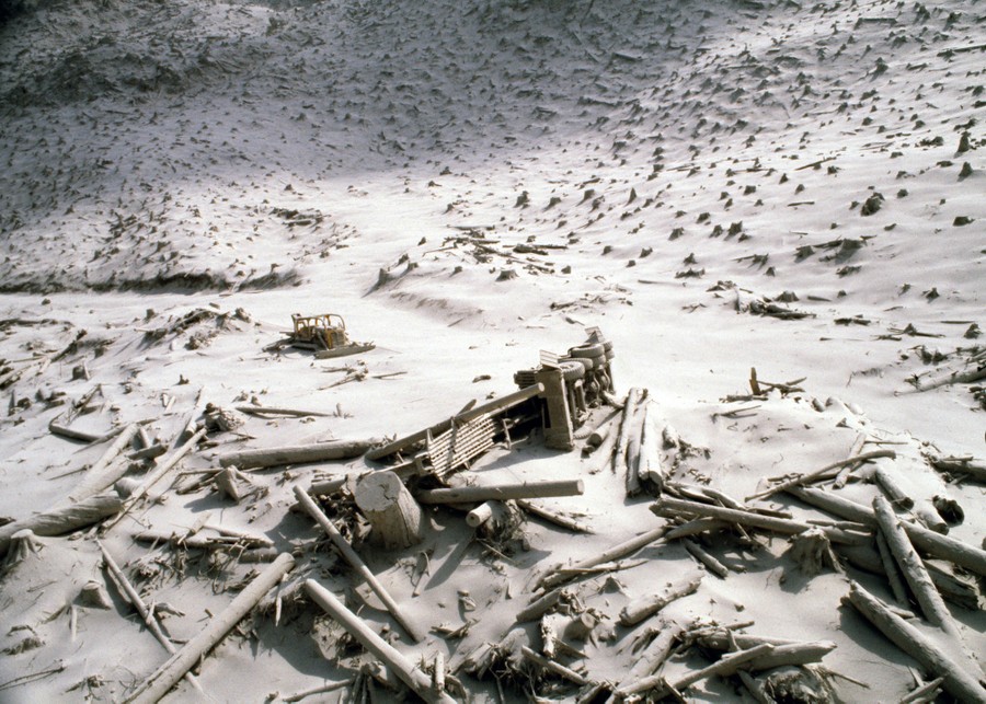
Damaged equipment on the south side of Elk Rock, northwest of Mount St. Helens, in Cowlitz County, Washington, on June 5, 1980 #
USGS -
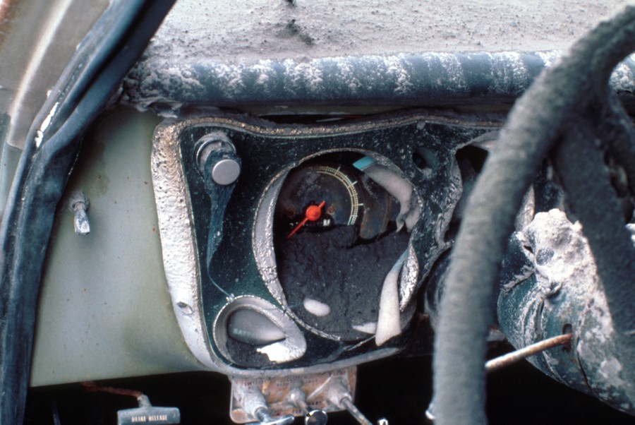
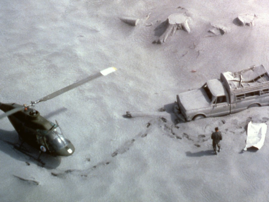
The melted dashboard of pickup truck located on the ridge top about 14 kilometers north of Mount St. Helens, in Skamania County, Washington, on June 18, 1980 #
USGS -
A National Guard member identifies victims of the eruption of Mount St. Helens. #
Ralph Perry / NPS -
An aerial view of the destruction of logging operations after floods following Mount St. Helens’s eruption, shown on May 20, 1980 #
Jack Smith / AP -
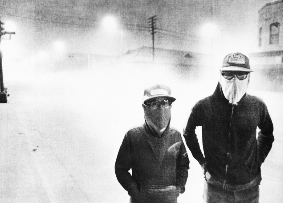
The streets of Yakima, Washington, are dark at 3 p.m. after the eruption of Mount St. Helens on May 18, 1980. Volcanic ash covered the streets as people wore masks to avoid breathing the particles. #
AP -
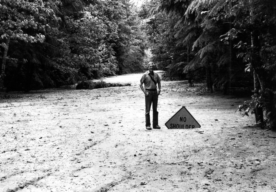
A solidified mudflow covers State Highway 504 near the town of Toutle, northwest of Mount St. Helens, to a depth of 6 feet. Geologist for scale. #
R.L. Schuster / USGS -
A wrecked logging truck and a crawler tractor are shown amid ash and downed trees near Mount St. Helens, two days after an explosive eruption. #
AP -

Heidi Havens, 15, gives Allen Troup, 16, a kiss as he prepares to board a Spokane City bus, on May 27, 1980. Spokane residents had to wear face masks while outside for days after the eruption, because of possible health threats from volcanic ash sprayed over the area by Mount St. Helens on May 18. #
Ralph Viggers / AP -
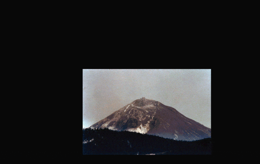
Mount St. Helens, shortly after the eruption of May 18, 1980 #
AP -
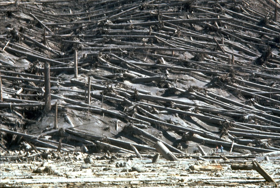
The slopes of Smith Creek valley, east of Mount St. Helens, show trees blown down by the May 18, 1980 lateral blast. Two U.S. Geological Survey scientists (lower right) give scale. The direction of the blast—shown here from left to right—is apparent in the alignment of the downed trees. Over 4 billion board feet of usable timber, enough to build 150,000 homes, were damaged or destroyed. #
Lyn Topinka / USGS -
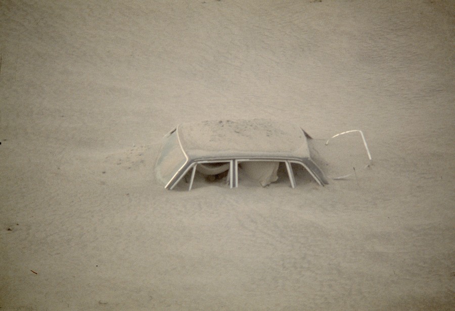
A car sits submerged in ash in this May 20, 1980 photo from the Mount St. Helens eruption in Washington State. #
AP -

Denuded trees lay like matchsticks in the changed landscape around Mount St. Helens, shown two days after eruption, on May 20, 1980. #
Jack Smith / AP -
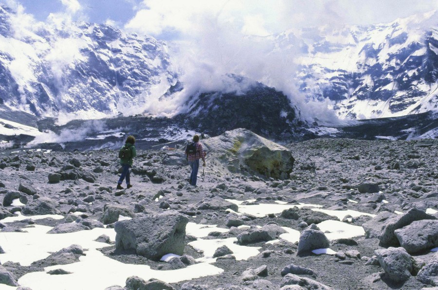
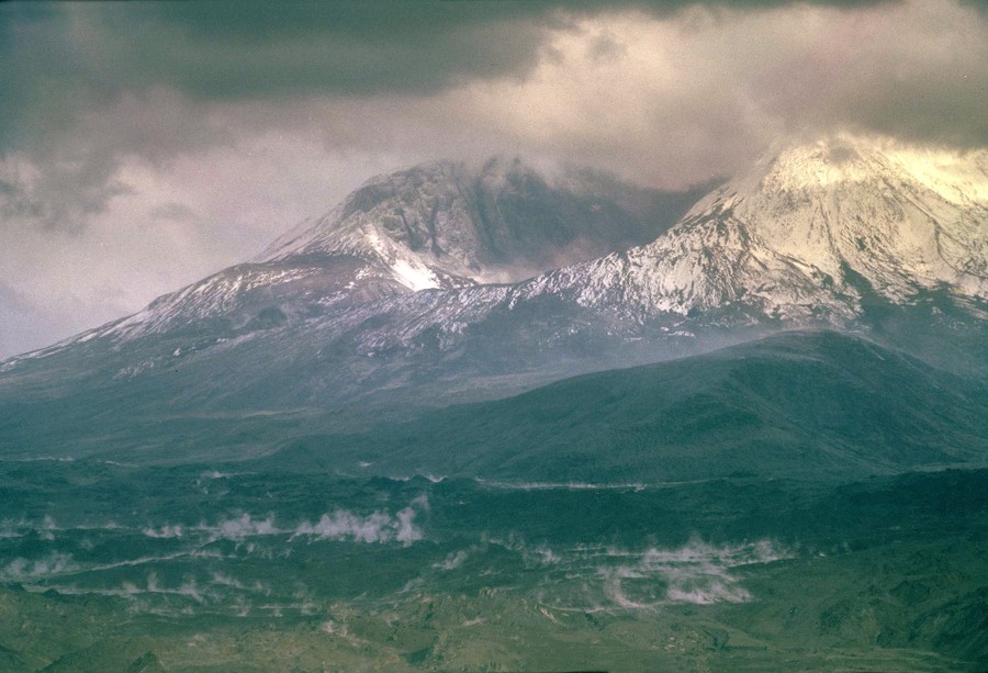
A Washington State geologist and a reporter walk toward the crater of Mount St. Helens on May of 1981, almost a year after the volcano exploded, causing dramatic destruction for miles around. They were near the steaming lava dome with the snow-covered crater wall beyond. #
Gary Stewart / AP -
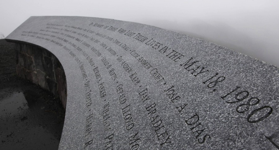
A memorial to those who lost their lives due to the May 18, 1980 eruption of Mount St. Helens, photographed on May 18, 2010, in Washington State #
Ted S. Warren / AP -
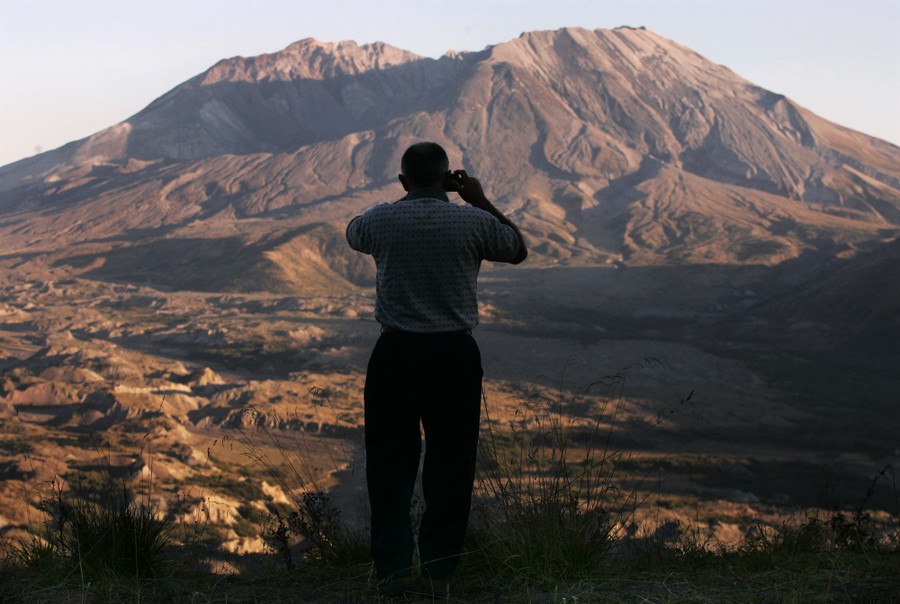
A tourist stops to take photos of Mount St. Helens during the sunset on October 4, 2004. #
Andy Clark / Reuters -
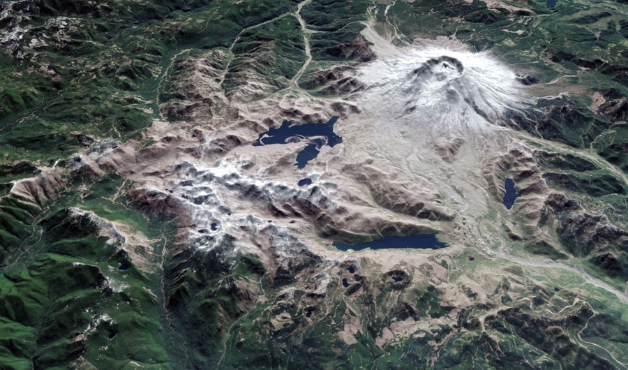
Satellites in orbit and scientists on the ground still monitor the mountain and track the recovery of Mount St. Helens. This image shows a three-dimensional view of the mountain, looking toward the southeast, as it appeared on April 30, 2015. The image was assembled from data acquired by the Operational Land Imager on Landsat 8 and the Advanced Spaceborne Thermal Emission and Reflection Radiometer (ASTER) on Terra. #
Jesse Allen and Joshua Stevens / NASA Earth Observatory


 Photographer Finds Locations Of 1960s Postcards To See How They Look Today, And The Difference Is Unbelievable
  Hij zet 3 IKEA kastjes tegen elkaar aan en maakt dit voor zijn vrouw…Wat een gaaf resultaat!!
 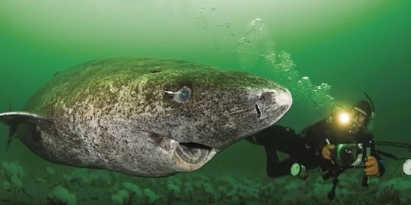 Scientists Discover 512-Year-Old Shark, Which Would Be The Oldest Living Vertebrate On The Planet
  Hus til salg er kun 22 kvadratmeter – men vent til du ser det indvendigt
  Superknepet – så blir snuskiga ugnsformen som ny igen!
  Meteorite That Recently Fell in Somalia Turns Out to Contain Two Minerals Never Before Seen on Earth
 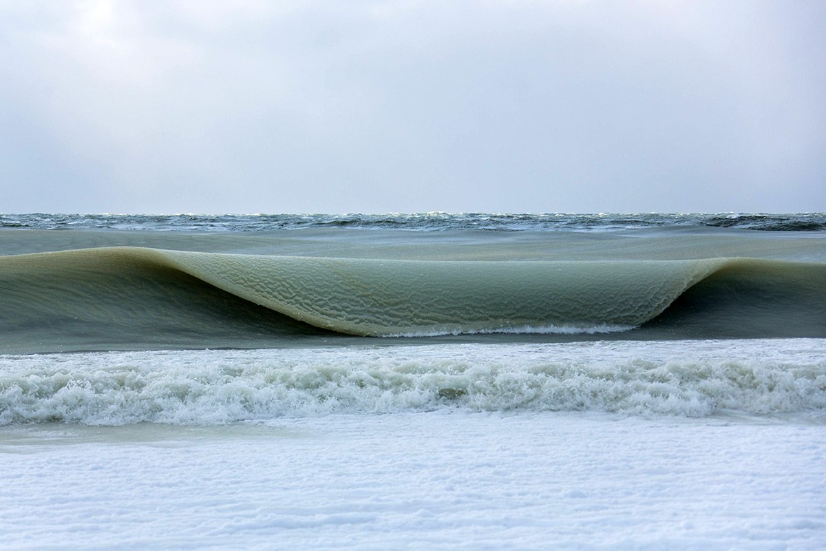 Nearly Frozen Waves Captured On Camera By Nantucket Photographer
  It’s Official: Astronomers Have Discovered another Earth