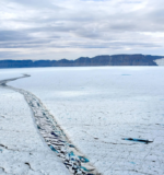
Learn how satellite radar captured the moment a Manhattan-sized ice island broke away from Greenland’s Petermann Glacier and why scientists are keeping a close watch.
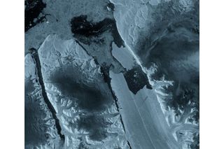
As summer progresses, one of the Arctic’s most significant ice-loss events has taken place in northwest Greenland. On Aug. 4, 2026, an approximately 30-square-mile chunk of ice, comparable in size to Manhattan, broke away from the Petermann Glacier. The event might have gone almost unnoticed if not for Europe’s Copernicus Sentinel-1 mission, a space-based radar observatory.
Petermann Glacier’s floating ice tongue, which extends into the Nares Strait, is one of the longest remaining floating glaciers in Greenland. Experts say the recent calving was the glacier’s largest loss of floating ice since 2012 and the biggest calving event in the Arctic since 2020.
“We’ve anticipated this break for years,” Adam Garbo, a Ph.D. student from the University of Ottawa involved in the glacier’s monitoring program, said in a European Space Agency (ESA) press release. “Seeing it finally happen is remarkable. It’s a powerful reminder of how quickly these systems can change.”
Space Radar Recorded Massive Ice Break in a Remote Polar Region
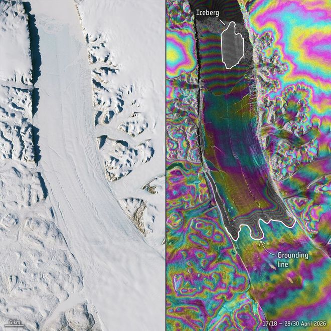
Optical image of an ice piece breaking away from Petermann Glacier
(Image Courtesy of the ESA/Comprenicus Sentienl/M. Hammond (University of Leeds/ CC BY-SA 3.0 IGO)
Sentinel-1 captured the start of the event on Aug. 3, 2026, when a large crack appeared along the centerline of the ice tongue. One day later, a massive, flat-topped iceberg had separated from the glacier’s eastern side. The new ice island is not only roughly the size of Manhattan but is also up to 500 feet thick.
Unbothered by cloud cover or daylight conditions, Sentinel-1’s radar imaging system operates day and night and collects data on global landscape topography, ocean imagery, ocean surface winds, snow and sea ice cover, to name a few, according to ESA’s SentiWiki — a fitting tool for tracking remote polar glaciers.
A group of scientists from Canada and the U.K. has been using Sentinel-1 to document the growth, fractures and signs of instability of Petermann’s floating ice tongue in Greenland since 2019.
The Break Was a Long Time Coming, and More Could Follow
Signs of trouble had been building for months. In April 2026, researchers compared multiple radar observations using a technique called interferometry. The resulting images revealed deformation and spreading fractures in the ice tongue, providing an early look at the changes that eventually led to the August calving.
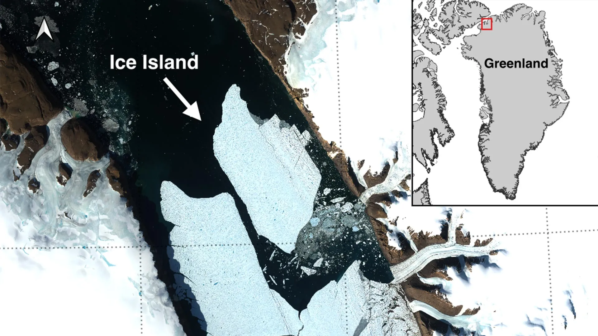
Petermann has experienced large calving events before, including major breaks in 2008, 2010, and 2012. But the latest event was the glacier’s biggest loss of floating ice in more than a decade. And researchers don’t think it will be the last: Two more large sections, measuring roughly 37 and 33 square miles, could break away as existing cracks continue to grow.
“While large, tabular icebergs are relatively common in the Southern Ocean around Antarctica, Arctic ice islands are far rarer,” explained Anna Crawford, a glaciologist from the University of Stirling, in the press release. “By studying Arctic ice islands, we will gain knowledge that can be transferred across polar regions. This is critical for understanding how the calving and deterioration of ice islands impact glacier dynamics, sea-level rise and the ocean environment.”
Keeping an Eye on the Large Iceberg as It Moves Across the Sea
For now, scientists will be watching what happens next. Satellite imagery, aerial observations, and tracking data will help researchers follow the new ice island as it drifts and gradually breaks apart.
There’s also a practical reason to keep a close eye on it. Environment and Climate Change Canada is tracking the iceberg’s movements because these enormous chunks of ice can remain at sea for years. As they fracture into smaller pieces, they can become harder to spot, which may create potential hazards for ships and offshore operations.
RELATED ARTICLES
Powerful magnitude 7.7 ea...
A massive magnitude 7.7 earthquake has hit Panama, damaging buildings and causing widespread shaking. About 4
What to See in the Octobe...
Saturn reaches opposition, Neptune lingers near Saturn, Mars transits the Beehive, and Jupiter is occulted by
This was the last lake of...
In a polar epishelf lake, freshwater floats on seawater, creating a unique ecosystem Jérémie Bonneau tr
Atlantic goes without a h...
The Atlantic has never gone this late without a hurricane since modern satellite tracking began in 1966.
Hummingbirds are migratin...
Ruby-throated hummingbirds are starting their fall migration, and a new map shows when they typically move sou

 Photographer Finds Locations Of 1960s Postcards To See How They Look Today, And The Difference Is Unbelievable
  Hij zet 3 IKEA kastjes tegen elkaar aan en maakt dit voor zijn vrouw…Wat een gaaf resultaat!!
  Scientists Discover 512-Year-Old Shark, Which Would Be The Oldest Living Vertebrate On The Planet
  Hus til salg er kun 22 kvadratmeter – men vent til du ser det indvendigt
  Superknepet – så blir snuskiga ugnsformen som ny igen!
  Meteorite That Recently Fell in Somalia Turns Out to Contain Two Minerals Never Before Seen on Earth
  Nearly Frozen Waves Captured On Camera By Nantucket Photographer
  It’s Official: Astronomers Have Discovered another Earth