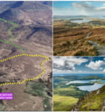

There are 2 versions of the Diamond Hill hike – the Lower Trail and the Upper Trail.
You’ll find Diamond Hill in Galway – head for Connemara National Park in Letterfrack and there’s a large car park at the visitor centre.
Below, I’ll take you through both trails (there’s a map for each):
- The Upper Trail: 6km long and takes around 2 hours
- The Lower Trail: 2.8km long and takes around 45 minutes
Some quick need-to-knows about the Diamond Hill hike
Photos via Shutterstock
The Diamond Hill loop walks are straightforward once you understand the lay-of-the-land. Here’s some key info:
1. Location
Diamond Hill in Galway is part of the Twelve Bens Mountain range in Connemara. It is located in Letterfrack, a 20-minute drive from Clifden, a 40-minute drive from Roundstone and a 1 hour and 15-minute drive from Galway City.
2. Height
Diamond Hill stands at 1,450 ft (442 metres) in height. While it isn’t one of the most challenging walks in Galway, it is one of the most rewarding view-wise.
3. Parking + warning
There is a large car park at the visitor centre (here on maps). Please note, as this is one of the more popular things to do in Galway, it can get very busy during the summer months, so arrive early.
4. The two trails
The Lower Trail is 2.8km long and takes around 45 minutes. While steepish in places, it will be doable for those with moderate fitness. The Upper Trail is 6km long and takes around 2 hours. It’s pretty steep at times, so you’ll need good mobility and decent fitness levels.
An overview of the two Diamond Hill walks

Take a moment to look at the map above, as it’ll give you a quick glimpse at where both trails take you.
As you can see, the lower trail avoids the steep hike to the summit while the upper trail offers an outstanding view of Connemara National Park on a clear day.
Below, you’ll find an overview of each route.
1. The Lower Diamond Hill walk

The Lower Diamond Hill walk is a looped trail that measures 2.8km in length.
Although doable for those with moderate fitness levels, it does have some modest climbs along the way.
I know of several people that have done this trail with kids (10+) and found it very doable.
While you won’t get the eagle-eye view that the summit affords, you’ll still be able to enjoy fantastic views of the surrounding Connemara countryside, coastline, and islands.
Things to know
- Difficulty: Moderate
- Time to climb: 45 minutes
- Starting point: Connemara National Park Visitor Centre
2. The Upper Diamond Hill walk

The Upper Diamond Hill walk is a continuation of the Lower Trail. It takes you up to the summit of Diamond Hill via a narrow ridge of quartzite that stretches for around half a kilometre.
For those that fancy giving this a go, the entire circuit of the Lower and Upper trails measures around 7km and should take you around 2 hours.
At the 445m-high summit, you’ll be treated to panoramic views across all of Connemara. Few hikes in Ireland offer a view that compares.
Things to know
- Difficulty: Strenuous
- Time to climb: 2 hours
- Starting point: Connemara National Park Visitor Centre
2. The Upper Diamond Hill walk
a map of the upper diamond hill walk
Click to enlarge
The Upper Diamond Hill walk is a continuation of the Lower Trail. It takes you up to the summit of Diamond Hill via a narrow ridge of quartzite that stretches for around half a kilometre.
For those that fancy giving this a go, the entire circuit of the Lower and Upper trails measures around 7km and should take you around 2 hours.
At the 445m-high summit, you’ll be treated to panoramic views across all of Connemara. Few hikes in Ireland offer a view that compares.
Things to know
Difficulty: Strenuous
Time to climb: 2 hours
Starting point: Connemara National Park Visitor Centre
Credit: www.theirishroadtrip.com


 Photographer Finds Locations Of 1960s Postcards To See How They Look Today, And The Difference Is Unbelievable
  Hij zet 3 IKEA kastjes tegen elkaar aan en maakt dit voor zijn vrouw…Wat een gaaf resultaat!!
 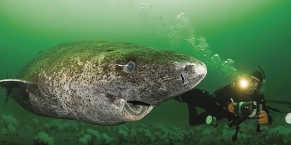 Scientists Discover 512-Year-Old Shark, Which Would Be The Oldest Living Vertebrate On The Planet
 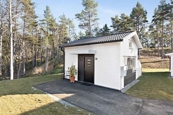 Hus til salg er kun 22 kvadratmeter – men vent til du ser det indvendigt
 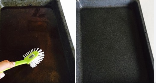 Superknepet – så blir snuskiga ugnsformen som ny igen!
 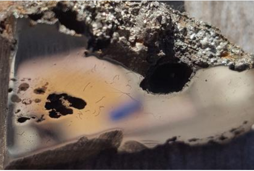 Meteorite That Recently Fell in Somalia Turns Out to Contain Two Minerals Never Before Seen on Earth
  Nearly Frozen Waves Captured On Camera By Nantucket Photographer
  It’s Official: Astronomers Have Discovered another Earth